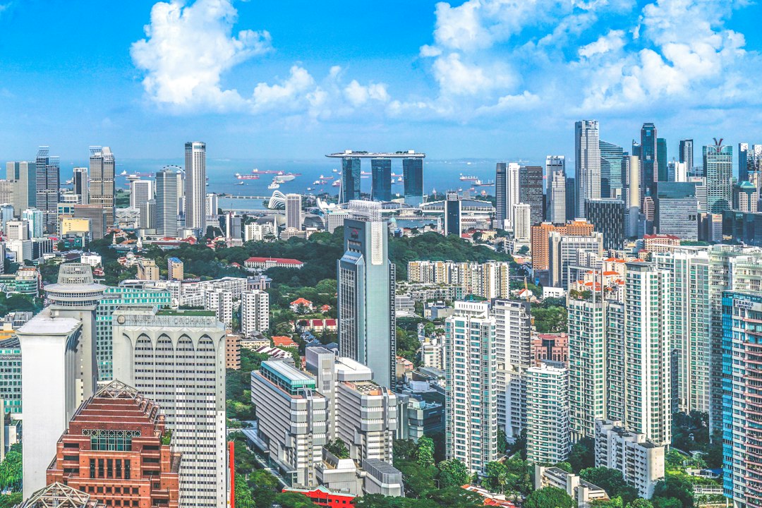
Singapore urban planning is often cited as a model for dense, land-scarce cities. With a small land area, a growing population and the need to fit housing, industry, water catchment, defence, airports and nature onto one island, the country has developed a layered planning system that sets long-term direction, translates it into statutory land-use plans, and controls individual developments in detail.
This article explains how that system fits together: the Long-Term Plan, the Master Plan, development control and the tools such as plot ratio that shape buildings. It also traces the system’s history, from the first statutory plan in 1958 to the Master Plan 2025, using the Urban Redevelopment Authority’s (URA) published material and the National Library Board.
Two levels of plan: long-term and statutory
At the top of the system sits the Long-Term Plan, formerly called the Concept Plan. It is a non-statutory strategy that looks 50 years and more ahead, deciding in broad terms where housing, industry, green space and infrastructure should go. URA reviews it roughly every ten years, and the most recent Long-Term Plan Review was completed in 2022 after a public engagement exercise.
Below it sits the Master Plan, the statutory land-use plan that guides development over the next ten to fifteen years. It is reviewed every five years and assigns every parcel of land a zoning, such as residential, commercial or business, and an allowable intensity, usually as a gross plot ratio. The Master Plan 2025 was gazetted on 1 December 2025 after an exhibition of the draft plan earlier that year. Our sibling article on the URA Master Plan looks at it in more detail.
Why two levels?
The split lets the government plan for needs decades away, such as moving an airbase, reclaiming land or relocating a port, without fixing details too early, while giving landowners and developers a clear, legally binding framework for current decisions.
A short history of Singapore urban planning
The first statutory Master Plan was completed in 1955 and approved in 1958. It set zoning and controlled development intensity through density for residential land and plot ratio for other uses. The Planning Ordinance, now the Planning Act, came into effect on 1 February 1960, the same day the Housing and Development Board was established.
The Concept Plan of 1971, prepared with United Nations assistance, set out the ring structure that still defines the island: high-density new towns, industrial estates and commercial centres arranged in a ring around the central water catchment, linked by expressways and later by the MRT. It was reviewed in 1991, when the vision shifted towards an island city balancing work, play, culture and commerce, and again in 2001.
The Urban Redevelopment Authority was formed in 1974 from the earlier Urban Renewal Department, and it became the national planning authority. In the 1990s, the Master Plan was made more forward-looking through Development Guide Plans prepared for the island’s 55 planning areas, which detailed the intended character and intensity of each district.
Development control: how individual projects are regulated
A plan only works if development follows it. In Singapore, almost any development, from a new tower to a change of use or an extension to a house, needs planning permission from URA as the competent authority under the Planning Act. URA’s development control guidelines set out the parameters for each type of development, including:
- Plot ratio, the ratio of gross floor area to site area, which controls how much can be built. It is explained in our article on floor area ratio.
- Building height, controlled by storey limits, technical height limits near airports, and urban design guidelines in key areas.
- Setbacks from roads and boundaries, which protect daylight, ventilation and future road widening.
- Site coverage and landscaping requirements, including replacement of greenery lost to development in certain areas.
- Use classes, which define which activities are permitted in each zone.
Planning permission is distinct from building plan approval. Once URA has approved the planning parameters, the structural, fire and building aspects are reviewed by other agencies, notably the Building and Construction Authority and SCDF. Our guide to BCA building plan submissions explains that second stage.
Conservation, nature and heritage in the plan
Singapore urban planning is not only about intensification. URA’s conservation programme, started with the gazetting of ten conservation areas on 7 July 1989, now covers almost 100 conservation areas and over 7,000 buildings. Conservation guidelines sit alongside zoning, controlling what can be changed in districts such as Chinatown, Little India and Tiong Bahru. Green planning has a similar status: parks, park connectors and nature areas are safeguarded in the Master Plan, and greenery replacement policies require new developments to put back landscaping.
The Master Plan 2025 organises its proposals around themes including a happy and healthy city, sustainable growth, urban resilience, and stewarding nature and heritage. These themes reflect a shift from meeting basic needs to managing quality of life, climate risk and identity in a mature city.
What planners are balancing
Every planning decision in Singapore trades off competing needs for the same land. Housing must be found near jobs and transport; industry needs large, flat sites with good access; water catchment, defence and airport safeguarding constrain heights and uses across large areas; and nature and heritage need space to survive. Some of the most visible current projects, such as the Greater Southern Waterfront and new housing in central and fringe districts, come from freeing land previously tied to the port, military or other uses.
For architects and engineers, the planning system sets the envelope within which design happens. A good understanding of zoning, plot ratio, height controls and conservation rules at the start of a project avoids redesign later, and informs early structural decisions such as basement depth, transfer structures and foundation type.
Lessons for other cities
Commentators often point to a few features that make Singapore’s approach distinctive: integration between land use and transport planning; the state’s role as the main landowner and housing provider; long planning horizons that are reviewed regularly; and the willingness to reserve land for future needs. Some of these conditions are difficult to replicate. The underlying principle, that long-term strategy, statutory plans and development control should be consistent with one another, applies to cities everywhere.
Frequently asked questions
Who is responsible for Singapore urban planning?
The Urban Redevelopment Authority is Singapore’s national land-use planning and conservation authority, preparing the Long-Term Plan and the statutory Master Plan and granting planning permission, working with other agencies such as HDB, LTA and NParks.
What is the difference between the Long-Term Plan and the Master Plan?
The Long-Term Plan is a non-statutory strategy looking 50 years or more ahead and reviewed about every ten years, while the Master Plan is the statutory land-use plan for the next ten to fifteen years, reviewed every five years.
When was the latest Master Plan gazetted?
The Master Plan 2025 was gazetted on 1 December 2025, following public exhibition of the draft plan earlier that year.
Do I need URA approval to extend my house?
Most extensions, additional storeys and changes of use need planning permission from URA, as well as building plan approval and structural design by a qualified person, so it is worth checking requirements before design begins.
Related reading
- Little India Shophouses: History, Styles and Conservation
- Lim Chong Keat and the Making of Singapore Modernism
- Joo Chiat Shophouses and Terrace Houses: A Heritage Guide
- Chinatown Shophouses: Styles, Structure and Conservation
Need structural input early, while planning parameters are still being set? Talk to our consultancy or get in touch.